Ground Water and Hydrophilic Chemicals

Outer Cape Water Quality Initiative: How do grass and natural lawns affect water quality?

Pesticides seem an easy target, but they really direct us to a much larger picture.

Grass lawns don't need to be stigmatized as wrong or bad but perhaps a new balance can be considered between grass lawns and natural (indigenous vegetation) lawns. The Outer Cape's thin soil conditions are brutal, acid and nutrient poor. The natural indigenous vegetation, like the residents, seem to thrive on the weather abuse.

Grass lawns are usually seeded on top of six to eight inches of loam or topsoil. Fertilizers are added to stimulate growth and all sorts of seeds will be successful there. The leaves will be enriched, sending out chemical calling cards to insects. To reduce unwanted "weeds" herbicides may be used. To discourage insects, pesticides may be used. Frequent watering, additional fertilizers and continued use of pesticides and weed killer may be needed. Indigenous animals will find no familiar food or habitat there.

Natural (Indigenous) lawns can be seeded with conservation mix over an inch or two of indigenous compost (obtained free from local transfer stations). We usually rake the compost in a little, seed and then add a once inch layer of mulch (also free from transfer stations) to mimic natural soil profiles.

When transfer stations chip brush, branches and leaves, bacteria and microorganisms begin the decomposition process. The new material can be used as mulch and the dark final product can be used as compost. The benefit of using natural decomposition products is that they already have indigenous pH and nutrient content and host a full range of decomposers that keep on working. Keep the small chips and roots in the natural mix to protect natural diversity in the insect/decomposer community. This mix also welcomes indigenous volunteer seeds and will evolve naturally.

The benefits of natural systems include: creation of habitat for indigenous animals; natural erosion control (all grass creates runoff); naturally filters out sediment and excess nutrients with root/leaf stem systems; never needs mowing; never needs watering (except for the first growing season; never needs fertilizer; never needs pesticides; never needs herbicides. The benefits of natural lawn systems for our drinking water quality include: water conservation; pesticide free, herbicide free and fertilizer free. 

A BETTER BALANCE BETWEEN NATURAL AND GRASS LAWN SYSTEMS WOULD ENHANCE CONNECTED HABITAT AND REDUCE CHEMICAL INFILTRATION INTO OUR DRINKING WATER.

Ground Water and Hydrophilic Chemicals

OUTER CAPE WATER QUALITY INITIATIVE: UNDERSTANDING CHEMICAL TRANSPORT

If you have an interest in more detailed educational information and links regarding this topic, we have just published the booklet "Ground Water and Hydrophilic Chemicals". 

Download: Ground Water and Hydrophilic Chemicals

Safe Harbor Environmental Advocacy Initiative

This water quality initiative advocates the protection of drinking water resources on the Outer Cape. We support educational programs that develop awareness of our aquifer, which is recharged through ground water infiltration. We also encourage collaborative local partnerships, between town boards and stakeholder groups and between Outer Cape communities, to investigate the social changes needed to reduce chemical infiltration and improve our ground water recharge systems. The following discussion points outline the basic goals of the initiative. 1. Drinking water sourced from areas where household waste is infiltrated should be identified as an areas for improvement, through education. 2. Drinking water sourced from areas where lawn and garden chemicals are infiltrated should be identified as areas for improvement, through education. 3. Reducing infiltration of known carcinogens. 4. Reducing infiltration of non-degradable pesticides. 5. Reducing infiltration of biocide cleaners. 6. Reducing infiltration of growth hormones. 7. Reducing infiltration of antibiotics. 8. Reducing infiltration of petrochemicals. 9. Reducing infiltration of nitrogen and phosphorus. 10. Developing reliable, full spectrum monitoring programs. 11. Developing alternative choices for household chemical products. 12. Developing retailer support for chemical product alternatives. 13. Reducing storm water runoff with effective ground water infiltration systems.

We encourage leaders in Outer Cape Towns to discuss and support these basic goals. Discussions should include concerned residents and the capable contributors found on Planning Boards, Boards of Health and Conservation Commissions. Protecting our drinking water resources from chemical infiltration is a common goal that can unite local groups and create regional partnerships.

We support regional environmental initiatives. These initiatives work to conserve financial resources as well as natural resources. Local and regional partnerships contribute to successful initiatives by more effectively participating in stakeholder interaction and education.

Safe Harbor, 2007 For more information contact Gordon Peabody at 508-237-3724, or gordonsafeharbor@yahoo.com


Native Vegetation Planting Guide

Habitat Restoration Guide for Planting Vegetation on the Outer Cape

Example of Native Golden Rod, flowering

Example of Native Golden Rod, flowering

Safe Harbor’s Restoration Guide for the Outer Cape links native vegetation with specific habitats, exposures and height. Using site-specific vegetation for habitat restoration contributes to higher survivability. This “cookbook” style booklet makes choosing plants easier, by integrating numerous, earlier versions of planting lists. We are grateful to Howard Irwin for his review of this booklet.

Download "Habitat Restoration Guide"

Safe Harbor Environmental Services, 2012

Safe Harbor Environmental works with all forms of environmental permitting. Safe Harbor specializes in sustainable, coastal habitat restoration, using innovative, low cost strategies. Publications on our website that may also be relevant include: “The Dirty Dozen” Identifying and Managing 13 Invasive Plants on Cape Cod; “Steep Slope Stabilization”; and “Salt Spray Events and Coastal Vegetation” documenting the role Tropical Storm events in selecting sustainable coastal vegetation.

Safe Harbor publications may be copied, circulated, and shared for educational purposes only. This work may be cited but in no way should it be altered, transformed, built upon, or used as an endorsement of other work or for commercial purposesGordon Peabody, Safe Harbor Environmental, November, 2011

Haiti Water Initiative

 OUR HAITI WATER PROJECT: EXCERPTS FROM OUR PAST EFFORTS Why spend money shipping water to Haiti when we could be sending water filters so they could have their own clean water? Think sustainability...

We had several good reasons for sending water filters to Haiti: Cholera is spread through contaminated water; bottled water is heavy and very expensive to ship and the empty bottles are creating plastic mountains. People should not be compelled to beg for life giving resources. Will a $20.00 water filter change the World? probably not by itself but if we send enough filters to change a family, school, a church or a village into a more sustainable, safer place to drink water, we may begin attracting attention to a new strategy and changing one small corner of the World.

The filter our we researched and selected is affordable ($20) can provide over 40 gallons per day of drinkable water from puddles...for a year. With Haiti's shipping infrastructure in ruins, we had to create opportunities for church groups and relief workers to deliver the filters for us, directly to those in need.

For more specific information on these filters, already in use in Haiti and elsewhere in the world, use this link: http://www.justwater.me/


Dispatch From Iceland

 By Tessera Knowles-Thompson

Editor’s note: When one of our Researchers mentioned she was spending the summer in Iceland, we thought it would be interesting to have a researcher in place at this important Climate Change location, to collect anecdotal information from local fishermen and farmers about changes they were experiencing. As a further challenge, we asked Tess to see if any of the anomalies might be linked.

Crouching on the shore of Iceland’s Vatnsnes peninsula, I pick up a volcanic rock from the black sand, examine the vesicular texture and try to imagine the rapid transformation from molten lava to solid, igneous rock. Several arctic terns fly above; one dives at my head -- I duck to avoid the warning signal and I’m startled out of my geological reverie back into the present. Across the inlet, the corporeal mountain range -- absent arboreal growth -- appears to wrinkle here and stretch there along the horizon. In this moment, I am alone, I see no apparent signs of other human life, and I am filled with a sense of timelessness.[i]


ICELANDIC SURFACE CURRENTS

For the past couple months, I have been researching the impact of climate change in northern Iceland. More specifically, I have investigated the complex interplay between the atmosphere and ocean currents, and the possible effects of changing water temperature and salinity on Iceland’s ecosystems. Many changes are occurring, that is clear, but are they anomalies, or do they signal long-term trends?

The geographic location of Iceland makes it a particularly compelling case study. The Gulf Stream and Atlantic Drift Currents deliver warm surface waters to the region. As these waters are exposed to Arctic winds, they lose heat to the atmosphere and cool, becoming more dense and sinking. More warm surface water is drawn north as the denser water sinks. This process creates deep-water currents, which reappear in Tropical Oceans. This convective process is called the Thermohaline Circulation (THC). This heat exchange contributes to warmer climates in England and Western Europe, at latitudes similar to Siberia.

In recent years, influx of Greenland glacial melt water has raised concerns that lighter density fresh water blanketing denser, salt water, may alter ocean-atmosphere thermal exchange.  This could prevent transition to the density required to sink into the deep currents.[ii] In Iceland’s Sixth National Communication and First Biennial Report under the UN Framework Convention on Climate Change it is noted that: “deep water will be reduced when more fresh water is introduced to the Nordic seas because of melting of glaciers, thawing of permafrost and increased precipitation. With the time series available now it is, however, not possible to conclude that the flow of deep water is decreasing.”

Researchers in Iceland are particularly concerned with hydrographic variability, or the change in water temperature and salinity over a certain period of time, in the three main bodies of water surrounding the island – Atlantic water from the south, Polar and Arctic water from the Arctic Ocean and water from the Nordic Sea. Periods of increased/decreased temperature and salinity are associated with larger scale climatic variations, but since the mid-1990s, the continuous warm period has shown no signs of stopping. In the past 15 years, the waters in the south and west of Iceland have increased by 1–2°C. [iii]  Because of this, certain trophic (feeding) interactions have been affected. Examining how the smallest creatures are affected by changes in their ecosystem is an important tool in understanding how those further up the food chain will react.

The decreasing number of sand eels, for example, is impacting populations of creatures further up the food chain, and because of this, fisherman, researchers and others who regularly pay attention to the presumably more valuable species, are taking note: “Increasing sea temperature and growing mackerel numbers around Iceland are having a direct impact on the collapse of sand eel populations upon which birds like Puffins and Arctic terns depend.”[iv]

Because fish contribute to a large portion of the economy in Iceland, it is not surprising that a vast majority of research is focused on the related ecosystems. With a 758,000-km2 exclusive economic zone, Iceland is the 19th largest fishing nation in the world.[v]

https://www2.ucar.edu/climate/faq/aren-t-computer-models-used-predict-climate-really-simplistic

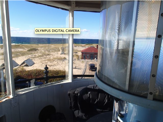
While working on a hostel on a farm, named Ósar for the inlets it overlooks, on a still day, I can see patches of dark water, which I’m told are large schools of mackerel. Knútur, the owner of Ósar, has called this land home since birth—as did the families of his father and his grandfather. He can trace his paternal lineage back to the first Norse settlers to arrive in Iceland thirty-two generations ago, between the years 874 and 930. As he says, things have changed in recent years. The most notable are those that have impacted the local economy. Mackerel, for instance, have gotten considerable attention recently because they were only spotted occasionally in Icelandic waters until the mid 1990s when the period of warming began. In 2007, mackerel was declared a regulated fishery in Iceland’s EEZ.[vi] Today, as noted above, they are now regularly found in large schools in the bay.[vii] The Icelandic fishing fleet uses about 200,000 tons of oil per year, and the diesel engines used by most boats release black carbon, which settles on the Arctic sea-ice. When this dark soot collects on these generally white surfaces, more heat is absorbed, leading to increased melt.

Paradoxically, the warming climate has extended the growing season in Iceland, making it possible for farmers to experiment with new crops—at least one of which could be converted into a viable alternative to diesel fuel. In 2008, the Icelandic Maritime Administration and the Agriculture University of Iceland began a project in cooperation with a handful of pioneering farmers to experiment with the cultivation of rapeseed. The oil extracted from Rapeseed (a variation of which is Canadian oil, better known as canola oil) can be converted into biodiesel, which “would mitigate the total emission of carbon dioxide from the Icelandic fishing fleet.”[viii]  Knútur was one of the first to join the project, and successfully yielded 4.1 tons of 93 – 95% dry seed per hectare (~10 acres) at each harvest between 2008 and 2011.[ix]

http://www.icenews.is/2011/06/29/skyrocketing-mackerel-numbers-around-iceland-blamed-for-puffin-crash/

http://www.fisheries.is/ecosystem/oceanography/ocean-currents/

http://www.icenews.is/2011/06/28/icelands-sea-bird-stock-in-dismal-shape/

[ii]

P.123 https://unfccc.int/files/national_reports/annex_i_natcom/submitted_natcom/application/pdf/nc6_br1_isl.pdf

[iii] Valdimarsson, H., Astthorsson, O. S., and Palsson, J. Hydrographic variability in Icelandic waters during recent decades and related changes in distribution of some fish species. – ICES Journal of Marine Science, doi:10.1093/icesjms/fss027.

[iv]

[v]https://unfccc.int/files/national_reports/annex_i_natcom/submitted_natcom/application/pdf/nc6_br1_isl.pdf

[vi] Astthorsson, O. S., Valdimarsson, H., Gudmundsdottir, A., and O´skarsson, G. J. 2012. Climate-related variations in the occurrence and distribution of mackerel (Scomber scombrus) in Icelandic waters. – ICES Journal of Marine Science, 69: 1289–1297.

Because fish contribute to a large portion of the economy in Iceland, it is not surprising that a vast majority of research is focused on the related ecosystems. With a 758,000-km2 exclusive economic zone, Iceland is the 19th largest fishing nation in the world.[xi]

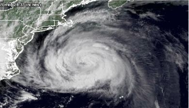
“The Arctic has experienced substantial and rapid changes in recent years [...]” the EU Arctic Organization ACCESS states, “These changes are most likely caused by a combination of natural variability of the high-latitude climate system, anthropogenic changes in the radiation balance and subsequently in atmospheric and oceanic heat transports, and feedbacks in the air/sea-ice/ocean coupled system.”[xii]

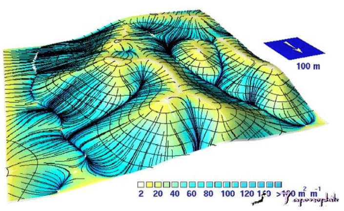
The climate system is incredibly complex, and so it is important to keep in mind the multitude of layers that exist. The model below serves as a reminder that nothing exists in a vacuum – everything, both anomalies and trends, are associated with these large-scale systems.

https://www2.ucar.edu/climate/faq/aren-t-computer-models-used-predict-climate-really-simplistic

***

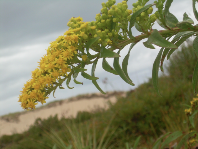
Lichens and moss both grow in abundance in Iceland. Lichens are “extremely versatile and often thrive in places where other vegetation has difficulty surviving”. Thus, lichens “account for an ever-greater share of mountain flora with increasing altitude, and lichens are often the first plants to colonise a freshly hardened lava field”. Some moss, I’m told, once trampled on, can take up to 100 years to grow back. [xxii]

Geological history proves that climate variations are natural, but with the unprecedented human activity of the post-Industrial Age, even the subtlest changes could signal a lasting trend. Therefore, the creatures (such as the sand eel) and plants (such as moss and lichen) most often overlooked deserve further investigation.

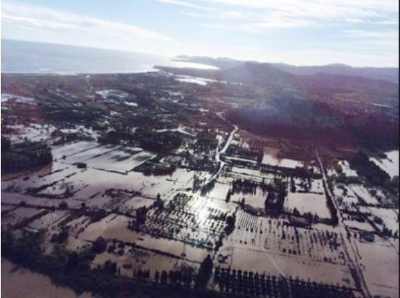
Without an immediate impact on our lives, or the lives of those directly connected to our web of compassion, this information remains just that: information to be filed away until another report makes headlines. The shock of a natural disaster often wakes us up, and some of us recognize the trends of increased regularity and proportions, but generally it is localized. Moreover, affected peoples and their allies remain preoccupied with the aftereffects, the immediate ramifications—mourning the loss of loved ones, rebuilding infrastructure, scavenging for or delivering food and water to those in need. Naturally, very few people pause to contemplate causes and connections to climatic events in faraway places. How could something that occurred thousands of miles away from us have an impact our lives? Even if we understand ocean currents, it is still a challenge to comprehend, let alone care enough to reflect on the ambiguous causes of these incidents, large and small, that are, perhaps, connected.

There are still many unknowns, and with the information we currently have available to us, we can make correlations, but clear causations are not yet possible. The trends, however, are indications that something has gone awry in the North Atlantic. Just like the drift current itself, the changes taking place are slow and, therefore, not easy to detect. Climate change in the Arctic is apparent, but the “drivers, evolution and ultimate impacts” remain unclear. [xxiii]

The more information we uncover about the ocean currents, the more prepared we can be for the changes that are to come. Regardless of the causes of the fluctuations in ocean temperatures, we need to know how this will affect us in the future. This includes the ways in which we are indirectly affected, which can only be understood by studying the impact that the changing climate has on the smallest of plants and animal species, and by the chain reactions that occur, ultimately leading up to us, humans.

Works Cited

Zofia Milligan Burr .“Climate variability, plankton and seabirds: a discussion on trophic interactions in the North Atlantic.” 2013. http://skemman.is/stream/get/1946/15673/37693/3/Zofia_Burr_L%C3%ADf38M_Final_Report.pdf

Steingrímur Jónsson. “Ocean Currents.” The Marine Research Insitute/University of Akureyri. Web. 20 July 2014.  http://www.fisheries.is/ecosystem/oceanography/ocean-currents/

Ice News. “Iceland’s Sea Bird Stock in ‘Dismal Shape.’” Web. 28 June 2011. http://www.icenews.is/2011/06/28/icelands-sea-bird-stock-in-dismal-shape/

Strategic Environmental Impact Assessment of Development of the Arctic. “Climate Change in the Arctic.” Web. 15 June 2014. http://www.arcticinfo.eu/en/eu-arctic-impact-assessment-factsheets-climate-change

Strategic Environmental Impact Assessment of Development of the Arctic. “Changing Nature of Arctic Fisheries.” Web. 15 June 2014. http://www.arcticinfo.eu/en/eu-arctic-impact-assessment-factsheets-fisheries

Valdimarsson, H., Astthorsson, O. S., and Palsson, J. “Hydrographic variability in Icelandic waters during recent decades and related changes in distribution of some fish species.” ICES Journal of Marine Science 69 (2012): 816–825.

Iceland´s Sixth National Communication and First Biennial Report Under the United Nations Framework on Climate Change. Web. 14 July 2014.

https://unfccc.int/files/national_reports/annex_i_natcom/submitted_natcom/application/pdf/nc6_br1_isl.pdf

[i] To be fair, I am due for an eye exam, so there is a possible discrepancy between what I see and what is actually there.

[ii] Strategic Environmental Impact Assessment of Development of the Arctic. “Climate Change in the Arctic.” Web. 15 June 2014. http://www.arcticinfo.eu/en/eu-arctic-impact-assessment-factsheets-climate-change

[iii] https://unfccc.int/files/national_reports/annex_i_natcom/submitted_natcom/application/pdf/nc6_br1_isl.pdf

[iv]

P.123 https://unfccc.int/files/national_reports/annex_i_natcom/submitted_natcom/application/pdf/nc6_br1_isl.pdf

[v] P.123 https://unfccc.int/files/national_reports/annex_i_natcom/submitted_natcom/application/pdf/nc6_br1_isl.pdf

[vi] http://www.nytimes.com/2014/08/12/science/in-the-ocean-clues-to-change.html?_r=0

[vii]  p. 1 Valdimarsson, H., Astthorsson, O. S., and Palsson, J. Hydrographic variability in Icelandic waters during recent decades and related changes in distribution of some fish species. – ICES Journal of Marine Science, doi:10.1093/icesjms/fss027.

Received 10 June 2011; accepted 17 January 2012.

[viii]http://www.argo.ucsd.edu/About_Argo.html

[ix] Valdimarsson, H., Astthorsson, O. S., and Palsson, J. Hydrographic variability in Icelandic waters during recent decades and related changes in distribution of some fish species. – ICES Journal of Marine Science, doi:10.1093/icesjms/fss027.

Received 10 June 2011; accepted 17 January 2012.

[x]http://www.icenews.is/2011/06/29/skyrocketing-mackerel-numbers-around-iceland-blamed-for-puffin-crash/

[xi]https://unfccc.int/files/national_reports/annex_i_natcom/submitted_natcom/application/pdf/nc6_br1_isl.pdf

[xii]http://www.access-eu.org/en/climate_change.html

[xiii] Hvitserkur is a plutonic rock, a sill from a long-ago volcanic eruption. The earth surrounding the rock has long since eroded, leaving this odd, stand alone formation.

Etc.

[xiv] Astthorsson, O. S., Valdimarsson, H., Gudmundsdottir, A., and O´skarsson, G. J. 2012. Climate-related variations in the occurrence and distribution of mackerel (Scomber scombrus) in Icelandic waters. – ICES Journal of Marine Science, 69: 1289–1297.

Received 4 October 2011; accepted 4 April 2012; advance access publication 4 June 2012

[xv] http://www.hafro.is/Astand/2014/39-engl-sum.PDF

[xvi]  P. vii

http://bondi.is/lisalib/getfile.aspx?itemid=4646

[xvii] Knútur Óskarsson, email communication, September 10, 2014

[xviii] http://bondi.is/lisalib/getfile.aspx?itemid=4646

[xix] http://icelandreview.com/news/2011/03/16/fuel-company-invests-rapeseed-oil-production

[xx] https://scripps.ucsd.edu/programs/keelingcurve/

[xxi]Rob Monroe, “What does 400 ppm look like?” Scripps Institute of Oceanography, December 3, 2013,

https://scripps.ucsd.edu/programs/keelingcurve/2013/12/03/what-does-400-ppm-look-like/

[xxii] http://www.nytimes.com/2004/11/30/science/earth/30moss.html?pagewanted=print

[xxiii] Strategic Environmental Impact Assessment of Development of the Arctic. “Climate Change in the Arctic.” Web. 15 June 2014. http://www.arcticinfo.eu/en/eu-arctic-impact-assessment-factsheets-climate-change

Tessera Knowles-Thompson

Herring River Restoration Project

By the end of 2007, the Herring River Technical Committee had completed its task of producing a Conceptual Restoration Plan and creating a second Memorandum of Understanding (MOU II) which linked the participants in the restoration planning process. A new committee, the HERRING RIVER RESTORATION COMMITTEE was also created by the MOU II. The Towns of Wellfleet and Truro, and the Cape Cod National Seashore were referred to as Entities, with their representatives carrying veto power. Four participating agencies necessary for restoration planning were referred to as Cooperating Agencies: USDA's Natural Resources Conservation Service; MA Coastal Zone Management; U.S. Fish and Wildlife Service and NOAA Wetlands Restoration Program. These representatives will work together, by consensus, to plan the proposed restoration.

TO REVIEW THE ENTIRE APPROVED CONCEPTUAL RESTORATION PLAN, PLEASE GO TO THE LINK BELOW:

http://www.nps.gov/caco/naturescience/herring-river-conceptual-restoration-plan.htm

AGENDA FOR NEXT MEETING

HERRING RIVER RESTORATION COMMITTEE July 15 Wellfleet Senior Center 10 AM

I. Update on Hydrodynamic modeling Kirk Busman Woods hole group II. Discussion of tasks for EIS Phase 2 contract III. Planning for First Public Scoping Meeting, August 14 IV. Review of revised CYCC Grading plans, Louis Berger Group V. Update on NEPA/ MEPA filings VI. Discussion of 6/24/08 MA Historic Commission response letter VII. Update on Friends of Herring River organizing VIII. New business IX. Next meeting

Previous Agenda

Herring River Restoration Committee

May 21, 2008

Agenda

I. Status of Hydrodynamic Modeling

II. Status of NOI filing for NEPA

A. Project Notification Form for historical and archaeological review

III Status of Special Project Review for MEPA

IV Status of planning for public scoping sessions this summer

V Status of Berger work

VI. Out come Of CYCC charrette A. formation of smaller working group with CYCC B. Formation of Third Party group

VII. Discussion of ACOE involvement in project

VIII adjourn

Most Recent Minutes of the Herring River Restoration Committee

Minutes of Herring River Restoration Committee CCNS Headquarters 3 April 2008 Members attending: Gary Joseph, Chairman (Wellfleet), Eric Derleth (US FWS), Charleen Greenhalgh (Truro), Steve Spear (NRCS), Steve Block (NOAA), Tim Smith (MCZM-MWRP), John Portnoy (CCNS) Others attending: Carrie Phillips (CCNS), Davis McGowan (DCR), Helen M. Wilson, John Riehl. Craig Wood, Spence Smith and Chris Gajeski represented The Berger Group. Minutes of the 21 February meeting were accepted unanimously after correcting the meeting location to Seashore Headquarters. A charrette at the Chequesset Yacht and Country Club is planned for 7 May from 10 AM to 3 PM to brainstorm alternatives to fund golf-course relocation out of the Herring River flood plain. The HRRC discussed whom should attend. John Riehl suggested that Ivan Ace, a CYCC member and past Friend of CCNS, be invited. A new option of filling existing fairways, instead of relocating them, was discussed. One benefit is that this plan preserves the CYCC undeveloped land, a valuable asset; however, it may be premature to include this option in the 7 May meeting. Phillips noted that the fill alternative will have to be considered in the EIS/EIR, but the charrette should focus on relocation, with filling only considered with respect to potential limits of funding. Derleth and Joseph agreed. Spear and Riehl suggested that we need to reconsider diking off Mill Creek, if all else fails to relocate the golf fairways. McGowan went over the CYCC charrette agenda, which will end with the identification of specific tasks and due dates. We discussed the "Yellow-book" appraisal of the 25-acre CYCC property, at only $400,000, much less than the anticipated $2.4-million value that led Wellfleet voters to promise a $1.2-million contribution from the Land Bank. Fate of the $1.2 million is now uncertain, but Joseph will follow up with Assistant Town Administrator Peterson. Greenhalgh suggested that the HRRC seek clarification from the town attorney on whether these funds can be re-authorized for use on some other aspect of the project. It was moved (Derleth), seconded (Block) and unanimously voted that the Chair write to Wellfleet administration requesting information regarding future use of the $1.2 million. Portnoy will draft some specific questions for HRRC review. Hydrodynamic modeling by the Woods Hole Group continues per their contract with some delays, per T. Smith. The HRRC discussed and rejected the idea of experimentally opening the dike's single sluice gate for model calibration. SERO regulatory meeting, 6 March. T. Smith presented the project. We received good support from all of the regulatory agencies. G. Joseph requested preparation of a brief presentation on project objectives, scope and progress for public programs. Portnoy will put this together and forward to the HRRC for comment. NOI and scoping for NEPA. Phillips expects it will take 6-12 weeks to get it published in the Federal Register after leaving the Park. EIS public scoping is planned for 2 PM on 14 August, including State MEPA, and at 7 PM on 24 September, both at the Wellfleet Senior Center. The comment period will be 60 days. Portnoy will check with the Cape Cod Commission on whether they are required to hold public scoping for a DRI, and, if so, whether they want to combine theirs with ours. Berger Group. Craig Wood, Spence Smith and Chris Gajeski represented Berger. They will provide their meeting notes from today. The HRRC gave Wood permission to contact Lindsay Gillham, project manager for EIS preparation under NPS funding, directly with questions, but asked that the Committee be copied on all correspondence. S. Smith noted that Berger will keep its own administrative record of their involvement of the project; this record is a deliverable at the end of the project. Re the towns' administrative record, H. Wilson noted that the HRRC is accountable to both Truro and Wellfleet for minutes and any emails pertinent to decision-making. Points of contact for Berger will be C. Phillips for NEPA and T. Smith for MEPA. We went over Berger's schedule. It was noted that Chapter 1 of the EIS requires input from public scoping, so it cannot be completed by Berger under the current contract schedule. The HRRC will look over examples of style and structure for Chapter 1 and provide Berger with a model to follow. A draft outline for this chapter, including project purpose, need, objectives and impact topics, is being routed for HRRC review by Portnoy, for transmittal asap to Berger. Wood urged that we begin contact with Mass. Historical Commission soon for MEPA, and after the NOI is published for NEPA; he will have Berger's archaeologist contact MHC. S. Spear said to include the Wampanoag, typically at time of public scoping. Berger will notify MNHESP, although prior meetings of this office with HRRC members, and at the 6 March SERO meeting, were noted. Wood advised that restoration of tides would increase the FEMA 100-year flood elevation upstream of the dike; however, it was noted that effects should be limited to already existing wetlands. This issue needs to be addressed in the EIS/EIR. The MWRP has asked Berger to prepare a proposal for the assessment of filling low fairways in the CYCC, recognizing that this alternative must be considered in the EIS/EIR. Spear suggested that fill volumes be computed for each 1-foot increment in final elevation. Our next meeting is planned for 10 AM on 21 May at Wellfleet Senior Center. Respectfully submitted, John Portnoy

Acidification and Oyster Mortality

OCEAN: RESEARCH ARTICLE   Download "OCEAN 31"  

Acidification and Oyster Mortality

Image courtesy of Martha's Vineyard Shellfish Group

Image courtesy of Martha's Vineyard Shellfish Group

Rising pH Levels Linked to Increased Spat Mortality. Economic, Ecological and Social Impacts on West Coast Oyster Industry

Ocean acidification is a present and future threat to a variety of ecosystems and biological processes (detailed in the OCEAN 30 issue by Safe Harbor), and one of the more recent and publicized victims of global warming is the oyster industry of the United States’ West Coast.

The oceans act like carbon sinks, and anthropogenic fossil fuel emissions have caused seawater to be 30% more acidic than pre-industrial times on a logarithmic scale. The eastern Pacific of the United States is particularly vulnerable to this decrease in pH because it already experiences deep upwelling and therefore inherently encounters more extreme acidic conditions more often. The driving force for the oyster farm failures along this shoreline is the inability for young oysters (known as spat) to develop successfully. The oysters are most vulnerable when young and just forming their calcium carbonate shells. This failure to thrive is due to a combination of extra energy required to form a shell (due to lack of necessary ions in the water now bound by acidic molecules) and possibly even dissipation of the fragile shells themselves.

Seed production in the Pacific Northwest plummeted 80% between 2005- 2009, with majority of the larvae dying within merely 2 days. To put into perspective how problematic this is the shellfish industry in this region contribute more than $250 million dollars to the economy annually and provides jobs for over 3,000 individuals. Parallel studies have started on the East Coast comparing conditions and bracing for future ocean acidification catastrophes. New Bedford, Massachusetts, is a major American port with shellfishing making up over 70% of its productivity, so job losses and community demographics would irreparably change for the worse if it is subjected to the consequences of ocean acidification like the Northwest Pacific has.

There has been much active research studying the mechanisms of spat failures and possible ways to rectify this problem both short and long term.  One example is Bodega Bay Marine Lab of UC-Davis working with Hog Island Oyster Company based in Tomales Bay, California. Hog Island raises their oyster spat in different water conditions in order to see the effects of various water quality scenarios, including excessive rain, water run-off, on the seed. The seawater of these tanks can be modified in real time if shell degradation is observed and documented for future hatcheries. Bodega Bay Marine Lab in turn records these fine scale aquatic changes in real time. It models how projected increased acidity will affect oysters and other shellfish in 10, 50 and 100 years in the future, and also how possible adaptations to counteract these caustic circumstances could help or hurt the oyster harvests.

Many of these susceptible oyster farms in the Pacific Northwest are multi-generational, family run companies who have to quickly troubleshoot this regional (and imminently global) disaster by changing techniques, importing spat, and monitoring water chemistry in order to adapt. One family, the Taylors of Shelton, Washington, have a separate oyster hatchery prior to planting in the Puget Sound. Hatcheries have been forced to incessantly monitor the incoming seawater acidity and either shut down flow is the water is too corrosive or add seagrass or sodium carbonate to help neutralize it more. This is a drastic change of how these companies have done things historically, but these alterations are a necessity in order to adapt to the changing seawater.

This, however, is just a stop gap. Models predict that corrosive water will be more prevalent at the sea surface and ubiquitous, up to 150% more, by the end of the century. The oyster harvest in the Northwest Pacific could increase by 25% over the next 50 years. This area is the canary in the coal mine- it is the first to show effects of increased acidification and gives insight on the dynamics of how these sensitive ecosystems will react. There are many short and long term strategies being constructed in attempts to rectify the situation, especially because of potential devastating consequences rippling up the entire food web. This research alone, costs from tens to hundreds of million dollars to complete. It is not cheap researching this evolving problem due to fossil fuel emissions; however, losing any of these shellfishing stocks would be detrimental on a much larger scale and immeasurable effects to local economies.

Thank you to OCEAN Researcher Brigid McKenna

More information in the link below:

http://www.nrdc.org/oceans/acidification/files/ocean-acidification-northwest.pdf

Sources:

http://www.nrdc.org/oceans/acidification/files/ocean-acidification-northwest.pdf

http://www.noaa.gov/features/01_economic/pacificoysters.html

https://www.youtube.com/watch?v=QRmWXKbKQYw

https://www.youtube.com/watch?v=1YWESqaNGUE

https://www.youtube.com/watch?v=x7MpI9dZIjk

Recycling Resources

Safe Harbor is a multidisciplinary environmental consulting group specializing in environmental risk assessment, coastal erosion response, conflict resolution and education. The Reallocation of Resources Initiative (RRI) was created as a pilot project in response to our organizations involvement in local building and understanding of the complexities surrounding natural and manmade resource recycling. RRI’s main goal is to decrease the amount of resources diverted to landfills by connecting local communities and green builders with reclaimed resources for Reuse with future construction and energy generation. A free downloadable copy of our publication is available below: 
Download: Reallocation of Resources Initiative

Lighthouse Vision Retreat

Screen Shot 2017-02-08 at 1.46.33 PM.png

Race Point Lighthouse, Provincetown Massachusetts  On October 24th through 25th, our team stayed on the edge of the Earth at Race Point lighthouse for a vision retreat.  I asked everyone to bring with them a vision of how they want to feel about working with Safe Harbor. I wanted us to share a vision of what Safe Harbor could be and develop some reachable goals together for the coming year.

I offered a field trip through the linked habitats of salt marsh, dunes, upper and lower beach and intertidal zone. We compared diversity with the degree of stress in each habitat. I had been involved in planning the restoration of this marsh.

We shared bedrooms in the restored Keeper's Quarters. The lighthouse has electricity, and amenities.  I asked our new Intern Zoe, to act as Retreat Coordinator.  Zoe coordinated arrangements and transportation with the Lighthouse Foundation and created menu choices for lunch, dinner and breakfast. After dinner we made time to share our thoughts together.

Funding for this retreat comes from an Environmental Vision Grant through Safe Harbor’s environmental education fund.

The Retreat:

Our Vision Retreat Handbook includes site specific information on marsh restoration, currents, erosion and deposition, as well as some commonly found plants and animals we are likely to encounter. 

For your own free copy, click on this link: RACE PT RETREAT

Alternative Foundation Systems

Helical Screw Piles and Diamond Pin Piles

Helical Screw Piles and Diamond Pin Piles provide foundation support without excavation, back-fill, form-work or concrete. Our free publication is downloadable, click on the link below

download: Alternative Foundation Systems

Wind Energy

A WIDE VARIETY OF INNOVATIVE VAT SYSTEMS ARE EMERGING.

THE SLIDE SHOW PRESENTS A FEW ALTERNATIVE WIND SYSTEMS THAT WE BELIEVE ARE WORTH CONSIDERING. THE ACCOMPANYING BOOKLET PROVIDES SOURCES. VAT NAYSAYERS POINT OUT THAT THESE SYSTEMS HAVEN'T BEEN ABLE TO PRODUCE PROMISED RESULTS AND SHOULD BE DISCARDED. IN RESPONSE TO THAT, SAFE HARBOR BELIEVES THAT SUSTAINABLE ENERGY SYSTEMS SHOULD BE AFFORDED THE SAME BIRTHING PERIOD AFFORDED TO CARBON. REMEMBER THE THREE REASONS WHY AUTOMIBLES WOULD NEVER BE SUCCESSFUL? "THEY ARE UGLY, THEY BREAK DOWN AND THEY SCARE THE HORSES.".

CLICK HERE TO DOWNLOAD A SAFE HARBOR WIND ENERGY SEMINAR PRESENTATION

FUTURE ZONING ON THE OUTER CAPE MAY CONSIDER WIND SHED VALUES AS A PROTECTED NATURAL RESOURCE. THIS WOULD PROTECT NEIGHBORHOOD ACCESS TO WIND AS AN ENERGY RESOURCE. FORWARD LOOKING COMMUNITY PLANNING SHOULD CONSIDER ENERGY ACCESS ISSUES SUCH AS ONE NEIGHBOR'S TREES OR STRUCTURES BLOCKING WIND OR SOLAR ENERGY TO ANOTHER NEIGHBOR'S PROPERTY.


Concrete Management Techniques

When using concrete near wetland resources, easy techniques are implemented to protect ground water. Concrete and rinse water characteristics can create nutrient over loading. This publication includes green building techniques that protect ground water quality. 

FREE PUBLICATION: Download "Concrete Management"


Marine Fisheries Impacted in the Gulf of Maine

OCEAN: RESEARCH ARTICLE

There is evidence that the fisheries industry in the Gulf of Maine is changing which has become a challenge to the livelihood of fisherman. According to the Gulf of Maine Research institute the water temperatures in the area have increased by 0.26°C every year since 2004.  As waters warm species travel north from their typical range to find preferential water temperatures.

The focus has generally been on cod, but this applies to all groundfish such as haddock, pollock and flounder which are typically managed together.  It is believed that the cod are going to deeper offshore waters, but according to scientist John Annala, it is a bit of a mystery as to where they have gone as they aren’t showing up in surveys, including ones done in Canada.  Fish from the Mid-Atlantic region have started moving north into the Gulf of Maine.  The species that are being found most often include butterfish, long fin squid, black sea bass and summer flounder.

While it seems that the fisheries industry would be alright as they could just switch to fishing different species, it is more complicated than that.  Different types of fish require different types of equipment to catch, which can be very costly.  Also, management practices are not in place for species that have not typically been found in the area.  There has also been an increase in lobster to the area, which would seem beneficial, but there has been an increase in lobsters that are shedding which sell for much less than the hard shell version.

Ecological issues can arise when new species move into an unusual territory.  The new species may compete with the historical species for food and habitat and there may be a lack of predators in the new range to keep the new species in check.  While some species may change their range, it is possible that they begin to change their habits to account for the change in temperature.  Examples include feeding at different times of day or shifting diets to account for loss of previous diet staples. It is possible that the whole food web of an area is altered and if equilibrium isn’t reached the ecosystem could crash.  Shell fishermen have also noticed an invasive green crab that has moved north with the warming waters and has become an unchecked predator. Phytoplankton are also affected by temperature.  In the ‘90s there was an influx of cold water that caused the phytoplankton to thrive, leading to increased numbers of zooplankton and herring (Jacobson).As the water warms, phytoplankton, the base level of the food web, could be disrupted causing instability in subsequent levels.  As the stability of the ecosystem decreases due to changing climate and species composition, it becomes more likely that it will not recover in the face of rapid change (Jacobson).

Thank You to OCEAN Researcher Nicole Smith

For more information on climate change in Maine and how it will disrupt not only the marine fisheries, but biodiversity and economics throughout the entire state go to http://climatechange.umaine.edu/files/Maines_Climate_Future.pdf and read the University of Maine document “Maine’s Climate Future: An Initial Assessment.”

Gulf of Maine Fisheries

This year's winter shrimp fishery in Maine failed to produce. The shrimp fishery failure has significant economic impacts for coastal communitiesThe possible causes may be changing water temperatures, poor management decisions, or over fishing. The shrimp fishery targets female shrimp just before they lay their eggs. The greater question is what lies ahead, socially, economically, and ecologically.

“Where have all the shrimp gone?”

            One of New England’s most historically prolific fisheries is now in jeopardy with an uncertain future. The shrimp industry, which has been predominately utilized by Maine fisherman for over half a century, may be facing a new threat that could potentially cease its existence as we know it. The 2013 season has been lining up to be one of the least productive in its history, and if it gives insight to the oncoming years, then its outlook is bleak.

Shrimp cultivation in the Gulf of Maine has not been without its fluctuations and modifications. It formally began in 1938, as an inshore winter fisheries. It subsequently expanded to an offshore, year round endeavor that peaked in 1969, collapsed in 1977, and shut down in 1978.  As a result of these events, stricter management was enforced to stabilize the stock. This meant limiting the season to three months peaking in late winter, setting daily and yearly limits as to how much may be caught, and even stipulating how many days per week one could fish. Additionally, the stock biomass level, a number calculated to support maximum sustainable yield and prevent overfishing, is set and referenced for these quotas. Since there is such range from year to year, federal and state agencies work together to constantly assess and compromise in consideration of both the shrimp and fishermen’s interests.

Exploitation of North Atlantic fisheries had not been limited to shrimp. Sardine canneries were once a fecund business in the U.S. beginning in the 19th Century, with over 400 factories based in Maine alone. Consisting of multiple species of herring, these small fish packed together proved to be a lucrative endeavor providing jobs in Maine until 2010, when the last processing facility in the country closed its doors. This was attributed to a difficult combination of decrease in consumer demand and an increase in government regulations for cultivating these fish.

Despite all of these cautionary measures put into place to preserve this shrimp stock, there has been a steady decline of shrimp caught in recent years, and may be the worst since it bottomed out in the late 70’s. In 2011, 13.3 million pounds of shrimp were netted, followed by 5.3 million in 2012. This year fishermen have been struggling to even reach half of the substantially lower allowable quota of 1.4 million pounds. Prices are reflecting this “bust,” and are close to $3.00 more per pound than last year. Regulators have attempted to assist fishermen with this struggle by loosening stipulations but it has not initiated a positive effect.

Some may argue that this stock came close to (or even teetered on) the tipping point previously when it had crashed completely in 1977, but then successfully rebounded. However, this occurrence was attributed to overfishing practices that were then corrected to allow regrowth of the population. It is thought that this recent trend of population decline could be due to warming ocean temperatures, an environmental variable much more difficult to influence.

The life cycle and seasonal transitions of the Gulf of Maine northern shrimp (Pandalus borealis) have been cited as to how the fishery is managed. Mature shrimp live offshore where they mate late summer to early fall. Mature females carry the embryos until they travel inshore to release the larvae. These spawning females are the main target of the fisheries because of location, quality and sustainability. The shallow position they dwell in throughout winter makes trawling easier and safer. These are the best quality because post-hatching females deteriorate in body condition. It maintains the specie’s viability due to the fact that these females spawn once and die, so the practice is not taking any productive females out of the ecosystems.

Through much research efforts it has been determined that this annual migration inshore is temperature dependent, meaning that changing oceanic temperatures would have a significant impact on these crustaceans. These northern shrimp have adapted to local temperatures and, accordingly, mating occurs to coincide with phytoplankton blooms. Phytoplankton is the main food source of the larvae, and being off by a slight period of time, even a week, has been argued to have a monumental impact. Female shrimp carry their eggs for almost half a year, and evolved to release hatchlings when food is most abundant. Eggs hatching too early lead to a poorer survival rate and these shrimp are not capable to adapt fast enough as temperatures drastically change.

The question at the forefront of this issue is: what is causing this temperature increase in our oceans? This is a controversial topic at present with convoluted hypotheses. Could it be the naturally occurring North Atlantic Oscillation or Arctic Oscillation links? Is it due to an anthropogenic global warming? There is much research being conducted to find out exactly what systems are active to cause these climate changes, and it is also logically possible that it could be a combination of nature and manmade influences. No matter what, a likely certainty if this “trend” continues is that the Gulf of Maine northern shrimp stock will not be the only shrimp fisheries negatively affected down the road and we must be prepared for what the future may hold if this is the case.

Thank you to OCEAN Researcher Brigid McKenna

Works Cited

Clark, Stephen, Steven Cadrin, Daniel Schick, Paul Diodati, Michael Armstrong and

David McCarron. “The Gulf of Maine Northern Shrimp (Pandalus borealis) Fishery: a Review of the Record.” Journal of Northwest Atlantic Fishery Science 27 (2000): 193-226. Web.

http://www.masswildlife.com/dfwele/dmf/publications/2_clark_et_al.pdf

Gill, Victoria. “Shrimp tuned to ocean temperature.” BBC News, 7 May 2009. Web. 7

May 2009.

http://news.bbc.co.uk/2/hi/science/nature/8037888.stm

“Gulf of Maine shrimp fishery goes bust.” Associated Press. Morning Sentinel, 13 Mar

2013. Web. 13 Mar 2013.

http://www.onlinesentinel.com/news/Gulf-of-Maine-shrimp-season-turns-into-a-bust.html

Richards, Anne, Jay O’Reilly and Maureen Taylor. “Oceanographic Indicators of Fishery

Management of Northern Shrimp (Pandalus borealis).” NOAA Research proposal (2006).

http://www.st.nmfs.noaa.gov/fate/proposal/06Richards.pdf

Rudalevige, Christine Burns. “Maxing out the mini season for Maine shrimp.” NPR.org

24 Jan 2013. Web. 24 Jan 2013.

http://www.npr.org/blogs/thesalt/2013/01/24/170157716/maxing-out-the-mini-season-for-maine-shrimp

Visbeck, Martin, James Hurrell, Lorenzo Polvanis and Heidi Cullen. “The North Atlantic

Oscillation: Past, present, and future.” Proceedings of the National Academy of Sciences of the United States of America. 98.23 (2001): 12876-1877. Web. http://www.pnas.org/content/98/23/12876.full

http://www.fishwatch.gov/seafood_profiles/species/shrimp/species_pages/white_shrimp.htm


The Devastation by Cyclone Cleopatra

OCEAN: RESEARCH ARTICLE

In mid-November 2013, Cyclone Cleopatra tore through the Italian island Sardinia, exacting long lasting damage in a matter of hours. The intense extratropical cyclone poured almost 18 inches of rain in an hour and a half and nearly destroyed this beloved western Mediterranean tourist destination. When rivers broke their banks it caused flash floods that swept away cars, washed bridges out and took the lives of at least 18 people.  

          A cyclone, by definition, is a system of winds that rotate around a low pressure area. They belong to a low pressure storm family that are categorized as cyclones, typhoons or hurricanes depending on geographical region. There are a variety of cyclone magnitudes ranging from mild to severe, with the largest of the low pressure systems being cold core and, as in this circumstance, extratropical. These mid-latitude cyclones can occur any time and are present in both hemispheres, and during the winter and when severe they are generally called “nor’easters.” Extratropical cyclones form as waves along weather fronts, and favor warm sea surface temperatures and atmospheric instability. Cyclone Cleopatra developed from northern cold air entering the Mediterranean and interacting with humid warm air, and because of increased sea surface temperatures due to climate change, it is highly possible that global warming strengthened this system since the difference between air and water temperature would be larger than before.           

           There was no choice by Italian officials other than to declare a state of emergency for this region within 24 hours of Cyclone Cleopatra’s commencement. It has been estimated that over 2,000 people had been affected by this natural disaster and £17 million for emergency relief has been allocated by the Italian government. The northeastern port city Olbia was among the most severely hit, and areas had been submerged in almost 10 feet of water-ruining roads and destroying homes.  For comparison, the amount of water that fell in 90 minutes is comparable to the rainfall in the city of Milan over 6 months. A local mayor deemed the storm “apocalyptic,” and experts have stated that this locale has not experienced a storm of this calibre in centuries. Other towns were hit by heavy rains as well coupled with gale force winds, and the heavy rains continued to threaten other parts of Italy, including Rome and Venice, while moving east days later.

          The geography of Sardinia has been devastated by Cyclone Cleopatra with its heavy rainfall and winds up to 58 mile per hour. Crops were ripped up and mud was spread across the landscape, which will affect agriculture production indefinitely in the region. Sardinia’s road and bridge infrastructure have been broken and severely damaged. This will not only impede access for relief efforts in the area but also yield the high priority task of rebuilding and repairing immediately. Italy has been in a fiscal recession for over two years, so these responsibilities may have unforeseen consequence by taking a higher toll on the unstable government and complicating restoration plans.

          There are bureaucratic complications to this tragedy as well. Italy has experienced more than two years of recession so may not be well prepared to deal with this unexpected crisis financially. An alert system was in effect but the efficiency of it is questionable since evacuation orders had been ignored and it has been said that the weather predictions were understated. Though this event was due to a variety of factors, the risk was said to have been heightened by faulty construction of buildings, especially in coastal areas, and need for better emergency planning.

          Needless to say that Cyclone Cleopatra has left a long road of healing and repair for the people of Sardinia. With climate change being very real, and the anthropogenic contributions to it, the potential of this or storms like this occurring again seems to be likely. Hopefully better, advanced preparations for these devastating natural disasters will minimize future detrimental effects and mortalities.  

Thank You to OCEAN Researcher Brigid McKenna

For more information:

http://www.dailymail.co.uk/news/article-2509741/Sardinia-storm-tears-Italian-island-causing-death-destruction.html

http://guardianlv.com/2013/11/sardinia-cyclone-prompted-state-of-emergency-in-italy/

Transdermal Chemicals in Your Body: Triclosan

Hand sanitizers and cosmetics as well as children's toys may contain triclosan. Exposure to this transdermal chemical allows it to enter the body through the skin. The same property of triclosan that interferes with bacterial functions may also impact human muscle function. While this is still being researched, this may be a chemical that bears tracking.

Recent studies have caused the FDA to think twice about the pervasive use of a common household bactericide, triclosan (Triclosan, 2012). Triclosan, which inhibits bacterial growth by specifically inhibiting an enzyme required for bacterial lipid biosynthesis (Levy, 1999), can be found in a wide variety of products from childrens’ toys to toothpastes and cosmetics (Triclosan, 2012). While one study has shown that triclosan can inhibit the growth of the parasite which causes malaria (Mcleod, 2001) and another has shown that it is effective in Colgate Total toothpaste in preventing gingivitis (Triclosan, 2012), there is no evidence which promises added health benefits in other products containing the chemical (Triclosan, 2012). Recent findings suggest that the chemical may be more harmful than beneficial. A study published in 2000 found that triclosan easily enters the bloodstream through dermal absorption (Howes et al, 2000). A study conducted in Sweden found the chemical in 3 out of 5 human breast milk samples as well as in fish exposed to wastewater (Adolfsson-Erici, 2002). Most recently, a team of researchers from the University of California, Davis has found that triclosan impairs the functioning of striated muscle cells in humans and whole muscles in mice and minnows (Cherednichenko, 2012). In human heart and skeletal muscle cells, the researchers found that contraction by electrical stimulation failed when the cells were in the presence of triclosan. In mice exposed to the chemical, a reduction in heart muscle function and grip strength was seen, while exposed minnows swam less effectively. The chemical appears to function by impairment of the calcium dynamics required for communication between two proteins required for muscle contraction (Stromberg, 2012). In light of these and other findings indicating potential negative health impacts, the FDA is “reviewing all of the available evidence on this ingredient’s safety in consumer products” (Triclosan, 2012).

Thank you to OCEAN researcher Lauren Bamford 03/09/2013

Read More at:

http://www.fda.gov/forconsumers/consumerupdates/ucm205999.htm

http://blogs.smithsonianmag.com/science/2012/08/triclosan-a-chemical-used-in-antibacterial-soaps-is-found-to-impair-muscle-function/

Works Cited

 Adolfsson-Erici, Margaretha. “Triclosan, a commonly used bactericide found in human milk and in the aquatic environment in Sweden.” Chemosphere 46 (2002): 1485-1489. Web. 9 March 2013.

Cherednichenko, Gennady. “Triclosan impairs excitation–contraction coupling and Ca2+dynamics in striated muscle.” Proceedings of the National Academy of Sciences of the United States of America August (2012). Web. 9 March 2013.

Howes, D., Moss, T., and Williams, FM. “Percutaneous penetration and dermal metabolism of triclosan (2,4, 4'-trichloro-2'-hydroxydiphenyl ether).” Food and Chemical Toxicology April (2000). Web. 9 March 2013.

Levy, Colin W. “Molecular Basis of Triclosan Activity.” Nature 398 (1999): 383-384. Web. 9 March 2013.

Mcleod, R. “Triclosan inhibits the growth of Plasmodium falciparum and Toxoplasma gondii by inhibition of apicomplexan Fab I.” International Journal for Parasitology 31 (2) (2001): 109-113. Web. 9 March 2013.

Stromberg, Joseph. “Triclosan, A Chemical Used in Antibacterial Soaps, is Found to Impair Muscle Function.” Surprising Science. Smithsonian Mag., 13 August, 2012. Web. 9 March 2013.

“Triclosan: What Consumers Should Know.” U.S. Food and Drug Administration.

Updated 29 August 2012. Web. 9 March 2013.

Native Coastal Plants and Hurricanes

SALT SPRAY ZONE PLANTS You are welcome to download your own copy of this new publication, by clicking on the link below. When the right forward quadrant of Hurricane Irene hit Cape Cod, we experienced an empirical vent of full wind but with no rain. This was an opportunity to assess salt impacts and survivability of native vegetation. We did a survey of direct and indirect impact sites and resurveyed the following spring. 6 pages of color photographs.

Download "Salt Spray Zone Plants"

Synopsis:

Coastal salt spray events are unwelcome but may play critical roles in selecting sustainable coastal vegetation. Changing storm tracks will create new liabilities for overly diversified coastal habitats. This publication documents Hurricane salt spray impacts on native coastal vegetation.

Medium Exposure site was located 800 + ft inland from the surf line. Onshore salt spray had to cross small buildings, a 2 lane road, low vegetationand a 4 lane road, with little change in elevation. The area consisted of 6-12 ft, established native and other vegetation.

High Exposure was located 10-60 ft from the surf line. The area consisted of recently planted and established, 1 ft -5 ft high native vegetation. Onshore salt spray, had to cross a 7 foot high coastal bank to impact the vegetation on a level grade.

Hurricane Irene, Satellite Image

Hurricane Irene, Satellite Image

The HurricaneIn late August, 2011, Hurricane Irene, with a 500 mile diameter Tropical Storm Force wind field, passed west of Cape Cod. The low precipitation, right hand semi-circle impacted Cape Cod from the Southwest50+ mph winds bridged tidal cycles for 15 hours. Prolonged wind, coated leaves and stems of exposed coastal vegetation with salt.

Unmitigated by precipitation, this became an empirical, “worst case scenario” for exposed vegetation, and an opportunity to study salt stress.

 Observations: Non-coastal natives were quickly dispatched by even the medium, albeit lengthy, exposure to salt spray. Established, native coastal plants, with the exception of Beach Plum, regained seasonal performance.  Directly following the storm event, recent plantings of Rugosa Roses and Seaside Goldenrod presented the appearance of100% salt kill. 2 weeks later, they were sprouting new leaves. 3 weeks after exposure, previously established Seaside Goldenrod showed flower heads (See cover photo on page 1), followed by blooms on a few, previously established Rugosas. Existing and planted American Beach Grass had minimal impacts.